


trimble
ID # 17931420
Trimble WM-Survey II App

In Stock
Call for Price


Overview
Specifications
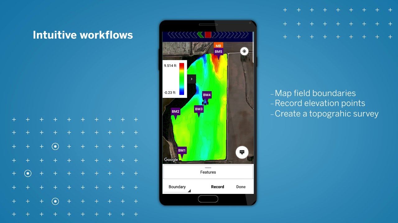
key benefits
auto-design subscriptions
terrace & waterway solution subscription
rice levee design subscription
wm-survey ii compatability
Videos
 Documents
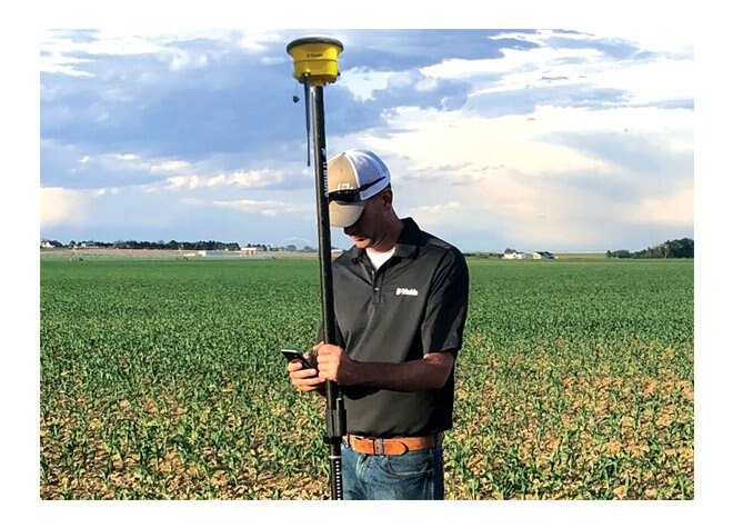
The WM-Survey II™ app is the only tool you need to get started with water management activities on the farm. This free-to-download mobile application makes it easy to create basic field surveys for use in water management activities, and automates the creation of terrace and waterway cross-section profile designs as well as auto-creates rice levee designs.
Compatible with any Android phone or tablet (version 9.0 or higher), as well as the GFX-750™ display, users can connect any GNSS receiver they own to their device to create topographic maps for use in a variety of surface and subsurface applications.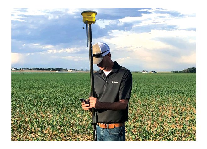
Model
WM-Survey II App
Category Name
Agriculture
Year
2021
Sale Type
New
Manufacturer
Trimble
Key Benefits
- Automated terrace and waterway cross-section profile designs
- Automated rice levee designs allow same day installation
- Get to work installing designs minutes after completing field surveys
- Intuitive workflows guide users and reduce errors
- Save time with quick and easy verification of surface or tiling designs
- Save money by using the survey equipment you already own
- Easily accessible entry-level application for beginning water management work
Auto-Design Subscriptions
Enabled through an optional subscription, WM-Survey II becomes even more powerful by automating the creation of certain surface drainage structures.
Typically reserved for our water management design software packages, this advanced feature set can generate terrace cross-section profile designs, waterway cross-section profile designs, rice levee system designs, as well as the 3D surface control files and navigational guidance lines needed by earthmoving equipment to implement the designs.
Terrace & Waterway Solution Subscription
Terraces and waterways are designed to divert water off a field such that soil erosion and crop loss due to water ponding is reduced. Terraces have a high side that prevents water from running over the top of it, while also typically sloping to the side to divert water into a waterway or ditch outlet along the edge of a field. Waterways transport water off a field to a designated outlet.
The Terrace & Waterway Design solution allows the user to easily and automatically create a basic terrace or waterway design in just five steps. The 3D control files and feature line guidance files for compatible Trimble displays are also auto-created, allowing land forming work to begin right away – no more waiting for designs to come back from the office. Farmers can now conduct their own maintenance, saving money on contractors by extending the life expectancy of terraces and waterways while preventing up to 5% yield loss in terraced fields.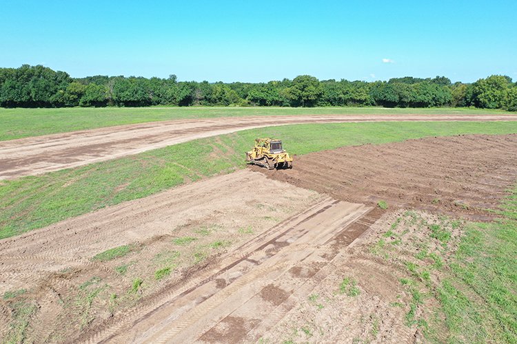
Rice Levee Design Subscription
Rice is grown in a consistent depth of water to help limit weeds, reduce insect infestations and boost overall crop health. Because fields have a minimum slope to one corner for drainage, rice levees are used to hold water at a constant depth across the elevation gradient of the field. As the water reaches the outlet of the field it is then pumped back to the top to restart the process.
The Levee Design subscription feature uses a four-step guided workflow to auto-create rice levees based on desired specifications and elevation across a field. Upon creation of the design, feature line guidance files are also exported and available for use in levee installation. Minimize yield loss from weather-delayed planting by getting to work implementing the designs right away. Eliminate the hours or days waiting for a designer to get back to you.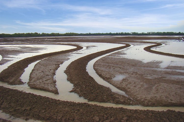
WM-Survey II Compatability
| Subscription | Description | GFX-750 | Android v9+ Device |
| Core App (free) | Create and display a topographic survey of the layout of your field | ✓ | ✓ |
| Import design file and verify a water management project | ✓ | ✓ | |
| Terrace & Waterway Solution | Auto-create terrace cross-section profile design based on elevation (.txt and .xml file export included) | ✓ | |
| Auto-create waterway cross-section profile design based on line placement (.txt and .xml file export included) | ✓ | ||
| Create 3D surface control files (.gps file export included) | ✓ | ||
| Create guidance layer in WM-Survey II app and/or guidance layer to display system (.shp file export included) | ✓ | ||
| Rice Levee Solution | Auto create levee design based on elevation (.txt and .xml file export included) | ✓ | |
| Create guidance layer in WM-Survey II app and/or guidance layer to display system (.shp file export included) |
Videos

 022503-1915A_WM-Survey-II_Brochure_USL_0821_LR-web.pdf
 Model
WM-Survey II App
Category Name
Agriculture
Year
2021
Sale Type
New
Manufacturer
Trimble
Quantity
1


Copyright© 2026 Dealer Performance Demo - Powered by Turn Key Web Solutions - Privacy Policy - All Items - Dealer Performance Login